Bird Crawl & Passport
WHAT IS THE BIRD CRAWL?
Think “pub crawl,” but with birds instead of beer – and driving instead of walking. The Bird Crawl is a self-guided, vehicle-based birding adventure where you meet up with biologists, scientists, wildlife spotters, and other local experts out in the field. We’ve selected several birding locations across Harney County that you can drive to on your own. At each stop, you’ll find a specialist who will help you spot birds, share local knowledge, and enhance your birding experience. How it works: ![]()
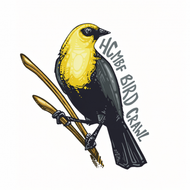
1) Purchase a Bird Crawl passport online (add it to your cart during registration), then pick it up in person:
– Thursday (Festival Kick-off day): Harney County Chamber of Commerce, before 5 p.m.
– Friday or Saturday: Bird Central (Geno’s Youth Center, 135 E Washington St, Burns), starting at 6 a.m.
2) Over the festival weekend, take your passport with you to Bird Crawl locations and get it stamped by a docent at each stop. Some guided tours even include Bird Crawl locations.
3) Bring your completed passport back to Bird Central by 12 p.m. on Sunday, April 19, and you’ll be entered into a drawing for something AWESOME.
Do I need a passport to participate? Nope! You’re welcome to visit Bird Crawl locations and talk with docents without a passport. The passport just adds a fun, collectible element—and a chance to win a prize.
What is the passport? It’s a small commemorative booklet you use to collect stamps at each Bird Crawl stop. Each passport also includes an annual sticker as part of the Harney County Migratory Bird Festival series. In 2026, we are featuring the Yellow-headed Blackbird, and keeping all Bird Crawl stops to the SOUTH! The 2026 Bird Crawl Passport is designed by video colorist and nature illustrator, Jasmine Vazquez.
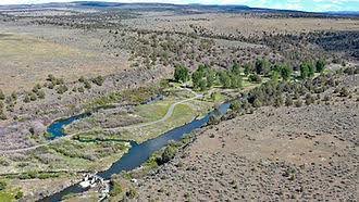
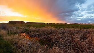
SELF GUIDED. Locations: Page Springs Campground, Buena Vista Overlook, P Ranch, Benson Pond, Malheur Refuge Headquarters
BIRD CRAWL LOCATIONS
Docents on site from 8 a.m. to 12 p.m., Friday and Saturday, April 17 and 18. Stamps available all weekend!
PAGE SPRINGS CAMPGROUND: Wrens, robins, quail, flicker, kingfisher
From the center stoplight in Burns at Parr Lumber, take State Highway 78 southeast for approximately 2 miles. Turn right onto State Highway 205 and travel south for 60 miles to Frenchglen, Oregon. Just past Frenchglen, turn left onto the Steens Mountain Loop Road. Follow the Loop Road for approximately 3 miles before turning into Page Springs Campground to the right, just across the Donner und Blitzen River.
BENSON POND: Great horned owls, swallows, tundra and trumpeter swans
From the center stoplight in Burns at Parr Lumber, take State Highway 78 southeast for approximately 2 miles. Turn right onto State Highway 205 and travel south for 47.1 miles. Turn left on Krumbo Reservoir Rd, then take the first right onto Center Patrol Road. Follow for approximately 1 mile to Benson Pond. Turn left; pond will be on your right.
MALHEUR REFUGE HEADQUARTERS: Great horned owls, Red Tail hawks
From the center stoplight in Burns at Parr Lumber take State Highway 78 southeast for approximately 2 miles. Turn right onto State Highway 205 and travel south for 23.9 miles to The Narrows, Oregon. Turn left onto Narrows-Princeton Rd/Sodhouse Ln. Follow for approximately 6 miles before turning left at Center Patrol Rd and into Headquarters.
P RANCH: Bullock’s Oriole, Willows Flycatcher, Cedar Waxwing, Western Tanager, vultures
From the center stoplight in Burns at Parr Lumber, take State Highway 78 southeast for approximately 2 miles. Turn right onto State Highway 205 and travel south for 60 miles to Frenchglen, Oregon. Just past Frenchglen, turn left onto the Steens Mountain Loop Road. Follow the Loop Road for approximately 2.5 miles, then turn left onto Center Patrol Road. The P Ranch is just ahead, on your left.
BUENA VISTA OVERLOOK: Wrens, swallows, sparrows, Bullocks Oriole, Western Kingbird
From the center stoplight in Burns at Parr Lumber, take State Highway 78 southeast for approximately 2 miles. Turn right onto State Highway 205 and travel south for approximately 38.7 miles, then turn left onto the gravel toward Buena Vista Station. Take the first right and follow the road around the hill and to the top of the knob to park and walk a very short distance to the overlook.